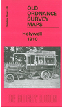
 Here are the details of maps for Holywell (W):

This detailed map covers the centre of Holywell and the area to the west, with coverage westward to Mwdwl-eithin and Saith-aelwyd.
Features include Pantasaph Farm, Grange Quarries, Holloway area, Coed Saith-aelwyd, Naid-y-march, Pen y Ball, Pen-y-ball Top, Smithy Gate, town centre with individual buildings neatly shown, Town Hall, most of High Street, St Winefride's School, St James church, Upper and Lower Mills, Great Holway lead mines, Coed y Fron, route of old railway, Wallside Mine, numerous old shafts for former lead mines, old quarries, Clwt Militia Office, etc. On the reverse we include an OS index map for the main part of Flintshire c.1872.