
 Here are the details of maps for Dyserth & Meliden:

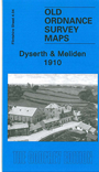
This very detailed map is double-sided for maximum coverage. The main map covers the village of Dyserth, famed for its waterfall, and coverage stretches west to Bodrhyddan Hall, east to Ochr-y-foel. Features include Tan-y-foel, Dyserth village centre, the station (terminus of the Prestatyn & Cwm Branch), Dyserth Stone Quarries, St Bridget's church, Dyserth Hall, Dyserth Castle, Talargoch Mine. On the reverse we extend coverage north with a large section of adjacent sheet 1.16, and this covers the village of Meliden, incl station, St Melyd's church, Nant-yr-ogof, Tan-yr-allt, Bryniau, Graig Fawr and several old mine shafts.