
 Here are the details of maps for Southend Pier and Seafront:

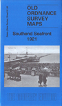
This detailed map covers Southend Seafront, including the pier, extending eastward to Plas Newydd and Winter Avenue.
Features include the Pier (shown complete), Corporation Landing Pier, Southchurch Hall Park, Kursaal, tramways, Marine Gardens, St John's church, Palace Hotel, Esplanade Restaurant, Ship Hotel, gas works, Gasworks Pier, etc
The map links up with sheet 91.02 Southend Town Centre to the north.
Maps in the Godfrey Edition are taken from the 25 inch to the mile map and reduced to about 15 inches to the mile. For a full list of maps for England, return to the England page.
Alan Godfrey Maps, Prospect Business Park, Leadgate, Consett, Co Durham, DH8 7PW / sales@alangodfreymaps.co.uk / 20 March 2019