
 Here are the details of maps for Westcliff-on-Sea:

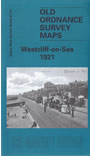
This detailed map and very busy map covers Westcliff-on-Sea and part of Chalkwell, west of Southend. Coverage stretches from Gordon Road and Baxter Avenue westward to Chalkwell Park, and from Westborough Road southward to the sea. Sheet 91.05 is included as an inset.
Features include railway with Westcliff station, tramways and depot, Nazareth House, cemetery, Sanatorium, St Alban's church, Hamlet Court, St Bernard's Convent, Queen's Hotel, St Saviour's church, Chalkwell Park, Chalkwell Hall, Lindisfarne College, many chapels, schools, cinemas etc. A long stretch of the Esplanade is covered. Ian Yearsley's introduction tells us how the various areas developed.
The map links up with sheets 90.04 Leigh-on-Sea to the west and 91.02 Southend Town Centre to the east.
Maps in the Godfrey Edition are taken from the 25 inch to the mile map and reduced to about 15 inches to the mile. For a full list of maps for England, return to the England page.
Alan Godfrey Maps, Prospect Business Park, Leadgate, Consett, Co Durham, DH8 7PW / sales@alangodfreymaps.co.uk / 18 June 2019