Old Ordnance Survey Maps of County Durham

  • These detailed maps normally cover an area of about one and a half miles by one mile. Each map includes an introduction.
  • They are available through our On-line Mapshop

  • Here are the details of maps for South Church:

  • Durham 42.07 South Church, Coundon Grange & Eldon 1915 - published 2022; intro by Tom Hutchinson. ISBN.978-1-78721-586-3

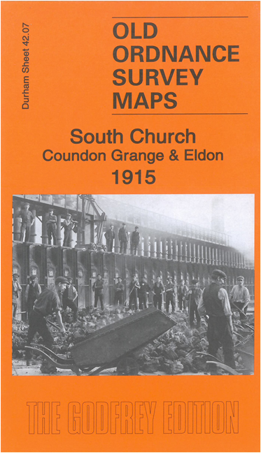
    This map is double-sided for maximum coverage. The main map covers the villages of South Church and Coundon Grange, SE of Bishop Auckland. Features include Auckland Park Colliery, coke ovens, remains of Adelaide Colliery, Eldon, St Mark's church, NER Black Boy Branch, Bishop Auckland & Weardale line, Haggerlease Branch, Eldon Colliery Railway, Eldon Lane, St Andrew's church, St Philip's church etc.

    On the reverse we include part of adjacent sheet 42.08 extending coverage east to include Eldon Colliery and Old Eldon Colliery, also the Gurney Pit of the Black Boy Colliery.

    The map links up with Durham sheet 42.11 Shildon to the south.


  • Follow this link for a complete list of our Durham maps.
  • You can order maps direct from our On-line Mapshop. For other information and prices, and other areas, go to The Index Page.
  • Maps in the Godfrey Edition are taken from the 25 inch to the mile map and reduced to about 15 inches to the mile. For a full list of maps for England, return to the England page.
    Alan Godfrey Maps, Prospect Business Park, Leadgate, Consett, Co Durham, DH8 7PW / sales@alangodfreymaps.co.uk / 7 October 2022