Old Ordnance Survey Maps of Durham

  • These detailed maps normally cover an area of about one and a half miles by one mile. Each map includes an introduction.
  • They are available through our On-line Mapshop

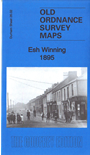
  • Here are the details of maps for Esh Winning:

  • Co Durham Sheet 26.02 Esh Winning 1895 - published 2019; intro by Alan Godfrey. ISBN.978-1-78721-233-6

    This detailed map covers the mining village of Esh Winning in the Deerness Valley.

    Features include village with individual buildings neatly shown, Flass Hall, East Flass, stretch of Dearness Valley Branch railway, Esh Villa, New House, Esh Colliery, old shafts and drifts, Cornsay Railway, waggonway, Stag's Head Hotel, coke ovens, etc. A directory of the village in 1894 is included on the reverse.

    The map links up with sheet 19.14 Esh to the north and 26.03 Ushaw Moor to the east.


  • Follow this link for a complete list of our Durham maps.
  • You can order maps direct from our On-line Mapshop. For other information and prices, and other areas, go to The Index Page.
  • Maps in the Godfrey Edition are taken from the 25 inch to the mile map and reduced to about 15 inches to the mile. For a full list of maps for the North East, return to the North East page.
    The Godfrey Edition / sales@alangodfreymaps.co.uk / 26 April 2019