Old Ordnance Survey Maps of County Durham

  • These detailed maps normally cover an area of about one and a half miles by one mile. Each map includes an introduction.
  • They are available through our On-line Mapshop

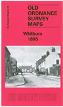
  • Here are the details of maps for Whitburn:

  • Co Durham Sheet 4.15 Whitburn 1895 - published 2014; intro by Anthea Lang. ISBN.978-1-84784-792-8

    This fascinating stretch of the Durham coast is covered by two maps, sheets 4.15 and 8.03, both of which are included here.

    Sheet 4.15 includes the southern part of Marsden, Whitburn Colliery, North Eastern Paper Mills, Lizard Point, Souter Point Lighthouse.

    Sheet 8.03 extends coverage southward to Whitburn village, where features include the Church, Whitburn Hall, Gas Works, lifeboat house, White Steel etc. We also include a 1906 directory of Whitburn.

    The map links up with sheet 8.07 Roker Seafront to the south.


  • Follow this link for a complete list of our Durham maps.
  • You can order maps direct from our On-line Mapshop. For other information and prices, and other areas, go to The Index Page.
  • Maps in the Godfrey Edition are taken from the 25 inch to the mile map and reduced to about 15 inches to the mile. For a full list of maps for England, return to the England page.
    Alan Godfrey Maps, Prospect Business Park, Leadgate, Consett, Co Durham, DH8 7PW / sales@alangodfreymaps.co.uk / 7 July 2018