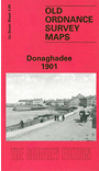
 Here are the details of maps for Donaghadee:

This very detailed map is is double-sided for maximum coverage.
Sheet 3.09 covers the northern part of the town, with coverage extending from Parade and the railway terminus northward to Foreland Point and the Light Keepers Dwellings. Features include Lemon's Wharf, Harbour with piers and lighthouse, Coastguard Station, Manor Farm, Glebe House, Carnathen Hill, Golf Links, Shore Street.
On the reverse is adjacent sheet 3.13, continuing coverage to the south of the town, as far as Galloways Bridge. Features here include most of the railway approach, Coalpit Bay, Robbys Point, Meetinghouse Point, Erin Lodge, Morey Hill, Manor House, Admiral Leslie's School, church, New Street, Manorhouse Pleasure Grounds.