Old Ordnance Survey Maps of Denbighshire

  • These detailed maps normally cover an area of about one and a half miles by one mile. Each map includes an introduction.
  • They are available through our On-line Mapshop

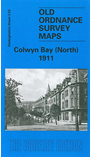
  • Here are the details of maps for Colwyn Bay North:

  • Denbighshire Sheet 03.03 Colwyn Bay (North) 1911 - published 2003; intro by Derrick Pratt. ISBN.978-1-84151-516-8

    This detailed map covers the northern part of Colwyn Bay, with coverage stretching from Penrhyn Road westward to Bryn Euryn and Bron-y-nant, and northward to Rhos Road. Features include a stretch of the LNWR railway, Colwyn Bay Hotel, St John's church, Rydal Mount, Ratonagh, Penrhos College, St Joseph's RC church, Bryn Euryn, Llys Euryn, Glan-y-wern, tramway, Walshaw etc. On the reverse we include adjacent sheet 3.04 which extends coverage eastward to include the station, Victoria Pier and Promenade.

    The map links up with sheets 3.07 Colwyn Bay SW to the south, 03.08 Colwyn to the SE.


  • Follow this link for a complete list of our Denbighshire maps.
  • You can order maps direct from our On-line Mapshop. For other information and prices, and other areas, go to The Index Page.
  • Maps in the Godfrey Edition are taken from the 25 inch to the mile map and reduced to about 15 inches to the mile. For a full list of maps for Wales, return to the Wales page.
    The Godfrey Edition / sales@alangodfreymaps.co.uk / 7 January 2018