
 Here are the details of maps for Helston:

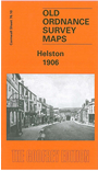
This detailed map is double-sided to give maximum coverage. The main map covers the centre of Helston, with coverage extending to the south and east. The town centre is in the top left corner of the map and features here include St Michael's church, Coinagehall Street, Cross Street, Castle Green, Wendron Street, Meneage Street, Market House, Workhouse. Coverage continues south along Meneage Road to Whitehill, with All Saints church, cemetery, and to Nansloe and Nansloe Farm; and eastward to Culdrose, Tresprison, Tregarrick. On the reverse we include a strip of the adjacent sheet 76.06 continuing coverage north to show the GWR Helston Branch with station, and this includes Lower Town, with corn mill and Treworlis tin works. A list of private residents in 1910 is also included.