Old Ordnance Survey Maps of Cornwall

  • These detailed maps normally cover an area of about one and a half miles by one mile. Each map includes an introduction.
  • They are available through our On-line Mapshop

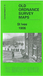
  • Here are the details of maps for St Ives :

  • Cornwall Sheet 61.12 St Ives 1906 - published 2012; intro by Tony Clifford. ISBN.978-1-84784-660-0

    This detailed map covers most of St Ives and includes sheet 61.12 and part of sheet 61.11, so extending coverage westward to Hellesveor and Hellesvean.

    Features include the town centre with individual buildings neatly shown, railway station, Stennack, Ayr, harbour, Porthminster Beach, Tregenna Castle Hotel, St Nicholas chapel remains, St Andrew's church, Porthminster Point, Bamaluz Point, Wheal Trenwith, Wheal Ayr, Bahavella, Porthmeor Beach, Carrick Du, Penbeagle, Hellesvean, St John's church etc. Extracts from a 1910 directory are included on the reverse.


  • Follow this link for a list of our maps for Cornwall or here for a general list for the South West.
  • You can order maps direct from our On-line Mapshop. For other information and prices, and other areas, go to The Index Page.
  • Maps in the Godfrey Edition are taken from the 25 inch to the mile map and reduced to about 15 inches to the mile. For a full list of maps for England, return to the England page.
    Alan Godfrey Maps, Prospect Business Park, Leadgate, Consett, Co Durham, DH8 7PW / sales@alangodfreymaps.co.uk / 13 January 2018