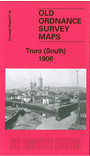
Cornwall Sheet 57.16 Truro (South) 1906 - published 2014; intro by Tony Clifford. ISBN.978-1-84784-779-9 
This detailed map is one of two we have published for Truro. This covers the southern part of the town, River Street and Boscawen Street
southward to Higher Newham.
Features include Truro River, The Green, Newham, River Kenwyn, Quay, Trafalgar Square, stretches of Newham Branch railway, Higher Town, Treyew Mills, Penwithers Junction, St John's church,
St Andrew's Mission chuch, Royal Cornwall Infirmary etc. Extracts from a 1910 directory are included on the reverse.
The map links up with Sheet 57.12 Truro North to the north.
Follow this link for a list of our maps for Cornwall or here for a general list for the South West.
You can order maps direct from our On-line Mapshop.
For other information and prices, and other areas, go to The Index Page.
Maps in the Godfrey Edition are taken from the 25 inch to the mile map and reduced to about 15 inches to the mile.
For a full list of maps for England, return to the England page.
Alan Godfrey Maps, Prospect Business Park, Leadgate, Consett, Co Durham, DH8 7PW / sales@alangodfreymaps.co.uk / 13 January 2018

 Here are the details of maps for Truro (South):