Old Ordnance Survey Maps of Buckinghamshire

  • These detailed maps normally cover an area of about one and a half miles by one mile. Each map includes an introduction.
  • They are available through our On-line Mapshop

  • Here are the details of maps for Chesham:

  • Buckinghamshire Sheet 39.09 Chesham 1923 - published 2006; intro by Pamela Taylor. ISBN.978-1-84151-932-6

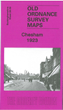
    This detailed map is double-sided to give maximum coverage. The main map covers the northern part of the town plus the area of countryside westward to Great Friars Hill. Features include Chesham Park, Broadway, High Street, Blucher Street, Broad Street, New Town, Broadlands, Severalls Avenue (near eastern edge of map), cemetery, Berkhampstead Road, Hiving's Hill. On the reverse we include part of adjacent sheet 39.13 extending coverage southward and this includes St Mary's church, Chesham Bois Manor, Amersham Works, Duck Alley, Elvidge Wood, Hodds Wood, Hilbury Wood. The station is split between the two maps.


  • Follow this link for a complete list of our Buckinghamshire or Milton Keynes maps.
  • You can order maps direct from our On-line Mapshop. For other information and prices, and other areas, go to The Index Page.
  • Most maps in the Godfrey Edition are taken from the 25 inch to the mile map and reduced to about 15 inches to the mile. For a full list of maps for the Buckinghamshire region, return to the Thames & Chilterns page
    The Godfrey Edition / sales@alangodfreymaps.co.uk / 27 January 2018