Old Ordnance Survey Maps of Cheshire


  • These detailed maps normally cover an area of about one and a half miles by one mile. Each map includes an introduction.
  • They are available through our On-line Mapshop

  • Here are the details of maps for Wilmslow:

  • Cheshire Sheet 28.05 Wilmslow 1907 - published 2023; intro by Chris E Makepeace. ISBN.978-1-78721-658-7

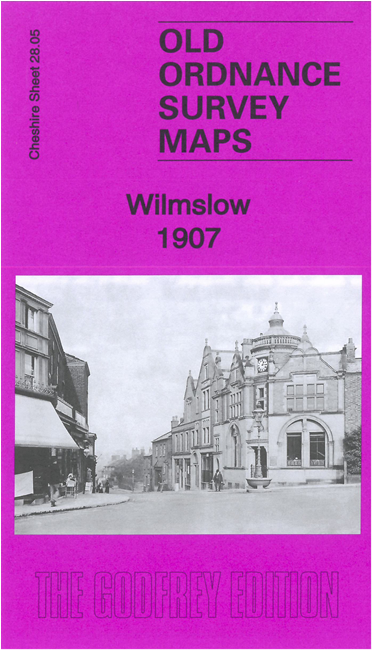
    This detailed map gives good coverage of Wilmslow, from Wilmslow Bridge and the town centre southward to the Kings Arms pub and Fulshaw Hall.

    Features include railway with station, St Bartholomew's church, Wilmslow Bridge, Bank Square, town centre with individual buildings neatly shown, Old Bridge, Lindow Common, Hawthorn Hall, Green Hall, Bollin Hall, chapels, many detached houses in grounds, etc.

    The map links up with sheet 28.09 Alderley Edge to the south.


  • Follow this link for a complete list of our Cheshire maps. For other information and prices, and other areas, go to The Index Page.
  • Maps in the Godfrey Edition are taken from the 25 inch to the mile map and reduced to about 15 inches to the mile. For a full list of maps for the North West, return to the North West page.
    The Godfrey Edition / sales@alangodfreymaps.co.uk / 1 November 2023