Old Ordnance Survey Maps of the Wirral


  • These detailed maps normally cover an area of about one and a half miles by one mile. Each map includes an introduction.
  • They are available through our On-line Mapshop

  • Here are the details of maps for Neston cum Parkgate:

  • Cheshire Sheet 22.14 Neston & Parkgate 1909 - published 2004; intro by Kay Parrott. ISBN.978-1-84151-639-4

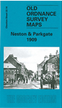
    This detailed map covers the village of Neston, on the Wirral, with coverage extending westward to Parkgate, on the waterfront. Features include Great Central Railway with Neston & Parkgate station, LNWR railway with Parkgate and Neston stations, Leighton Court, St Mary & St Helen's church, The Cross, Raby Park, Moorside, Manor House, Dee View Cottages, Mostyn House, Leighton Banastre, Bleak House, Leighton, Neston High Street etc. On the reverse we include 1898 directories of Great Neston and Parkgate, plus a railway timetable for the Hooton to West Kirby line.


  • Follow this link for a complete list of our Wirral area maps.
  • You can order maps direct from our On-line Mapshop. For other information and prices, and other areas, go to The Index Page.
  • Maps in the Godfrey Edition are taken from the 25 inch to the mile map and reduced to about 15 inches to the mile. For a full list of maps for the North West, return to the North West page.
    The Godfrey Edition / sales@alangodfreymaps.co.uk / 27 January 2018