 Here are the details of maps for Altrincham:

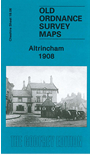
This detailed map covers the centre of Altrincham, plus parts of Bowdon and Hale. Coverage stretches from Margaret Road eastward to Hermitage Road, and from Altrincham Market Place southward to East Downs Road, Bowdon.
Features include railway with Altrincham & Bowdon and Hale stations, carriage shed, Stamford Park, Gas Works with tramway, Hale Moss area, Hydropathic Establishment, town centre in detail, Timperleyhall Farm, with moat, Fish Pond, St Margaret's church, St Peter's church Hale, Culcheth Hall, Consumption Hospital, St John's church, Town Hall, Market Hall etc. On the reverse we include a selection of street directory entries, including George Street, High Street, Moss Lane, New Street, Oxford Road, Shaw's Lane.
The map links up with Cheshire sheets 18.02 Altrincham North to the north.