Old Ordnance Survey Maps of the Wirral


  • These detailed maps normally cover an area of about one and a half miles by one mile. Each map includes an introduction.
  • They are available through our On-line Mapshop

  • Here are the details of maps for Hoylake (S):

  • Cheshire Sheet 12.07 Hoylake cum West Kirby 1909 - published 1991; intro by David Thompson. ISBN.978-0-85054-452-7

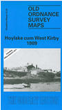
    This detailed map covers the area between Hoylake and West Kirby, with coverage stretching from Riversdale Road northward to the Royal Liverpool Golf Club. Other features include the north part of the LNWR station at West Kirby, St Andrew's church, golf course, Grange Hill, Leas School, large villas facing the sea, public hall, etc. On the reverse we include most of adjacent sheet 12.06 including Hilbre Point and also Hilbre Island and Middle Island, in the earlier 1871 survey.

    The map links up with Cheshire sheet 12.03 Hoylake to the north and 12.11 West Kirby to the south..


  • Follow this link for a complete list of our Wirral area maps.
  • You can order maps direct from our On-line Mapshop. For other information and prices, and other areas, go to The Index Page.
  • Maps in the Godfrey Edition are taken from the 25 inch to the mile map and reduced to about 15 inches to the mile. For a full list of maps for the North West, return to the North West page.
    The Godfrey Edition / sales@alangodfreymaps.co.uk / 27 January 2018