 Here are the details of maps for Nenthead:

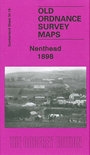
This detailed map is double-sided for maximum coverage. It covers the village of Nenthead which in the 19th century grew into a mining town of over 2,000 people, developed by the Quaker London Lead Company, and with pensions, education and health resources that foreshadowed the Welfare State. By the time of this map it was in rapid decline, and during the 20th century the population sank to around 350. The main map covers the northern part of the village, including Whitehall, Holmsfoot, Wellgill Dykehead, Brownleyhill Dressingfloor, Greenends, Foulard, and stretching east to Haggs Mine and Nentsberry. On the reverse is a large section of adjacent sheet 42.03 which covers the village centre and the Rampgill Mine, part of which forms today's Nenthead Mines Heritage Centre.