Old Ordnance Survey Maps of Cumberland

  • These detailed maps normally cover an area of about one and a half miles by one mile. Each map includes an introduction.
  • They are available through our On-line Mapshop

  • Here are the details of maps for Wigton:

  • Cumberland Sheet 29.05 Wigton 1924 - published 2014; intro by Alan Godfrey. ISBN.978-1-84784-819-2

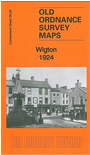
    This detailed map of Wigton is double-sided for maximum coverage.

    The main map covers the town centre and the area north and west. Features include St Mary's church, Durafit Works, Thomlinson Girls' Grammar School, Bog, tannery, Western Bank, railway with station, Preserve Works, Printfield, Standingstone, Highfield House (former workhouse), Wigton Hall, Friends Meeting House, Aikhead.

    On the reverse we include part of adjacent sheet 29.06 extending coverage eastward to include Nelson School, Burnfoot, Convent and St Cuthbert's RC church, Public Baths, East End.


  • Follow this link for a complete list of our Cumberland Series maps.
  • You can order maps direct from our On-line Mapshop. For other information and prices, and other areas, go to The Index Page.
  • Maps in the Godfrey Edition are taken from the 25 inch to the mile map and reduced to about 15 inches to the mile. For a full list of maps for England, return to the England page.
    Alan Godfrey Maps, Prospect Business Park, Leadgate, Consett, Co Durham, DH8 7PW / sales@alangodfreymaps.co.uk / 8 January 2018