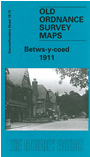
 Here are the details of maps for Betws-y-coed:

This detailed map of Betws (or Bettws) is double-sided for maximum coverage. The main map covers the village, then westward to Pentre-du, and northward to Aber-llyn Lead Mine. Features include railway with station, goods yard, St Michael's church, village centre with individual buildings neatly shown, Afon Llugwy, Fedw Hendre, Clogwyn Cyrau, Coed Aber-llyn, Greffyn Lead Mine (disused), Albert Roller Mill, Clogwyn Dinas, old lead mines and shafts, River Conway.
On the reverse we include a portion of adjacent sheet 24.01 extending coverage southward to include Hafod-las Quarry with incline; southern part of village incl Waterloo Hotel, Waterloo Bridge, Coed Gartheryr, Pen-y-clogwyn.