
 Here are the details of maps for Llanberis:

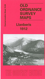
This detailed map is double-sided for maximum coverage. The main map covers the small town of Llanberis with coverage extending westward to Ffridd-glyn Slate Quarry, eastward across Llyn Padarn to Vivian Slate Quarry and northward to Vaynol Slate Quarry.
Features include town centre with individual buildings neatly shown, LNWR railway with station, tramway, Padarn Villa Hotel, Ffridd-glyn Slate Quarry, Chwarel Cae'r-meinciau, Glyn-rhonway Slate Quarry, old inclines, old workings, Dinorwic Quarry Railway, Vivian Slate Quarry, Allt Wen, Vaynol Slate Quarry (disused), Factory Cottages old quarries etc. The map is especially interesting for its coverage of the quarries.
On the reverse we include part of adjacent sheet 16.12 extending coverage south to include Snowdon Mountain Railway as far as Hebron station, incl Waterfall station, engine shed, viaduct; also Coed Victoria, Pentre-castell, Royal Victoria Hotel, St Padarn's church etc.