
 Here are the details of maps for Bury Town Centre:

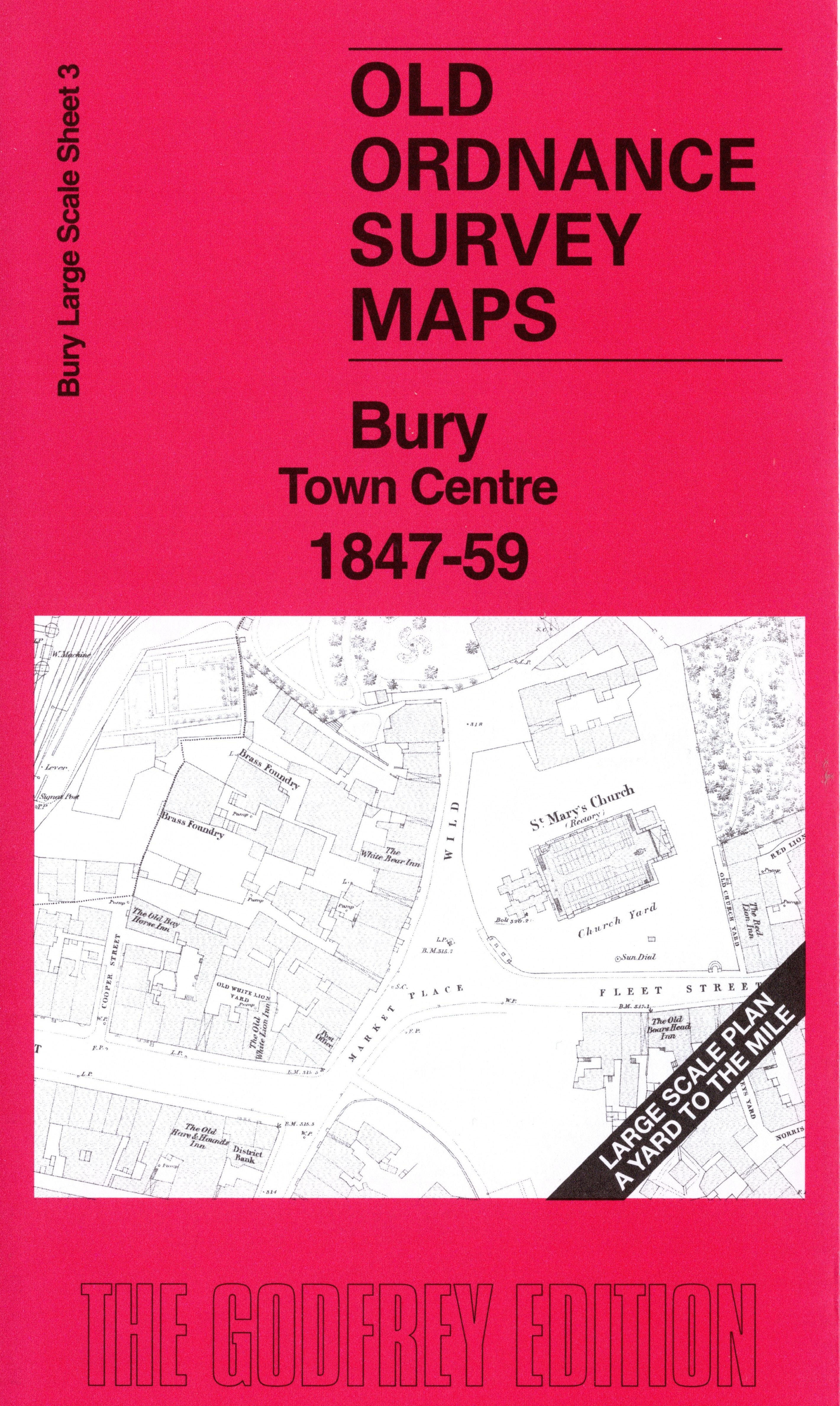
This map covers the centre of Bury in wonderful detail. Features include the East Lancashire Station, Carriage Works, Goods warehouse, St Mary's church, Congregational Chapel, Unitarian Chapel, River Irwell, Manchester Bolton & Bury Canal, Bridge Mills, Soho Works, Brooksmouth Mill, Irwell House, St Mary's RC Chapel, New Market Place, Bury & Prestwich Turnpike, etc. The map was surveyed in 1847 but some railway information has been updated to about 1859.
On the reverse we include 10 foot to the mile sheet 88.9.7 covering the Market Place and Town Centre in 1890, together with a 2,000 word introduction to the history of the area.
The map links up with sheet 5 Bury Buckley Wells to the south.