Old Ordnance Survey Maps of Buckinghamshire

  • These detailed maps normally cover an area of about one and a half miles by one mile. Each map includes an introduction.
  • They are available through our On-line Mapshop

  • Here are the details of maps for Olney:

  • Buckinghamshire Sheet 2.15 Olney 1899 - published 2007; intro by Barrie Trinder. ISBN.978-1-84784-088-2

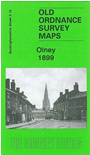
    This detailed map is double-sided for maximum coverage. The main map covers the northern part of the town, including the High Street, station, River Ouse, and extending eastward to Newton Lodge and Lavendon Mill. On the reverse we include a good section of adjacent sheet 5.03 and this is the busier map; it extends coverage south to show the southern part of the town, incl Market Place, church, Cowper's House, Tannery, Silver End, Near Town, brewery, plus the village of Clifton Reynes, with St Mary's church.


  • Follow this link for a complete list of our Buckinghamshire or Milton Keynes maps.
  • You can order maps direct from our On-line Mapshop. For other information and prices, and other areas, go to The Index Page.
  • Most maps in the Godfrey Edition are taken from the 25 inch to the mile map and reduced to about 15 inches to the mile. For a full list of maps for the Buckinghamshire region, return to the Thames & Chilterns page
    The Godfrey Edition / sales@alangodfreymaps.co.uk / 27 January 2018