 Here are the details of maps for Bolton Trinity Street:

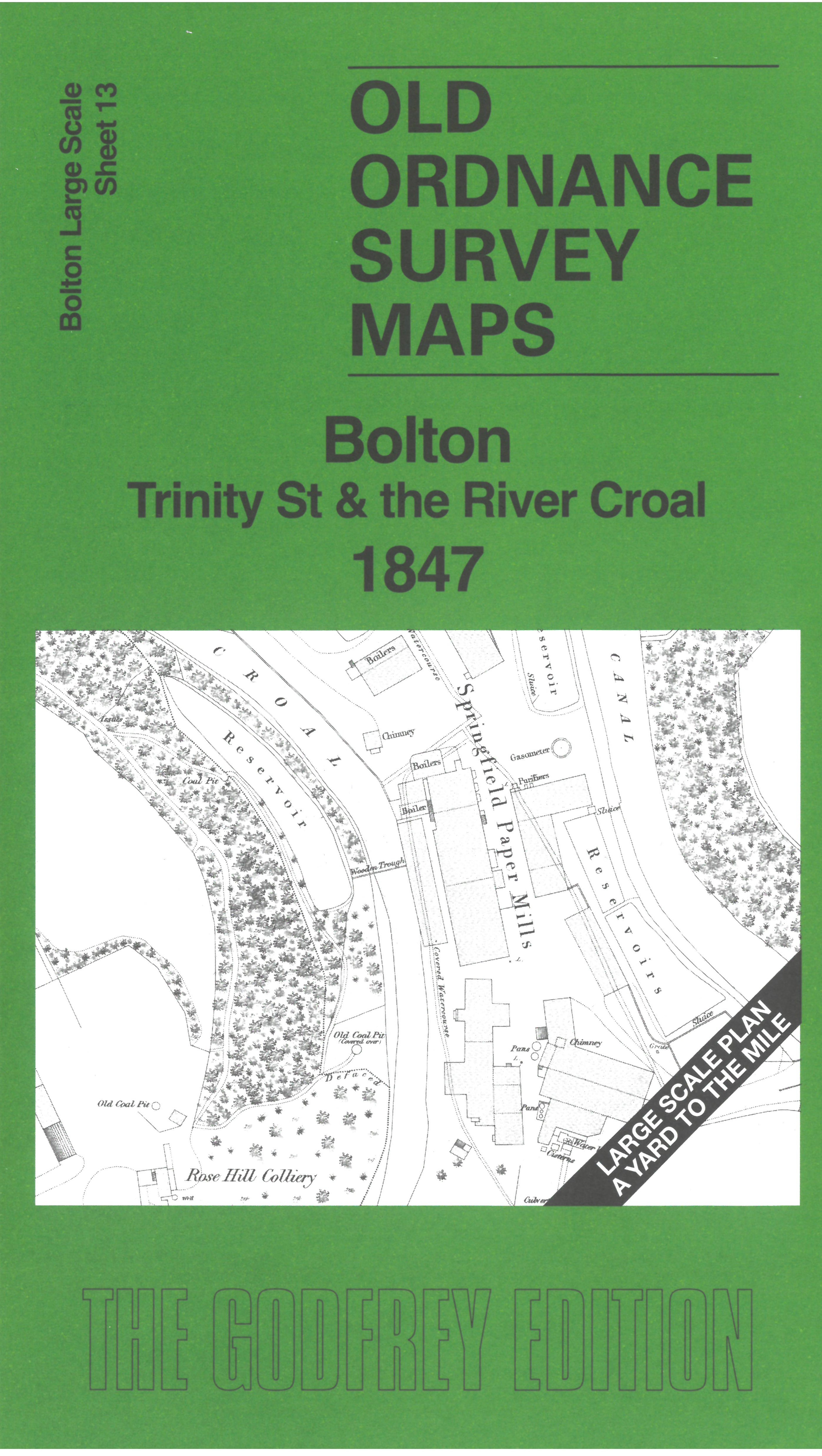
This very detailed map covers the eastern part of central Bolton, from Trinity Church eastward to the River Croal, Haigh Hall and the Manchester Bolton & Bury Canal. Other features include Rose Hill Colliery, Bolton Baths, Bradshawgate and the Bolton & Manchester Railway's Trinity Street station.
On the reverse we include 10 foot to the mile sheet 87.13.15 covering the Bridgeman Place area in 1890, together with a 2,000 word introduction to the history of the area. Note that these 1890 maps on the reverse of Bolton sheets 8, 9, 12 and 13 are also designed to link up with each other.
The map links up with sheet 9 Bolton Town Centre to the east and 12 Bolton Great Moor St to the south.