Old OS Town Plans of Bolton


  • This map is taken from the Ordnance Survey's highly detailed Five foot plans. Originally published at a scale of 1:1056 or 5 feet to the mile, we have reduced them in scale to 1:1760 or a Yard to the Mile. The maps, though covering quite a small area, are finely detailed, showing such features as capstans and mooring posts, lamp-posts, the layouts of back yards, and even the interior of certain buildings such as churches. For the urban historian they are perhaps the most fascinating maps ever published by the Ordnance Survey.
  • They are available through our On-line Mapshop

  • Here are the details of maps for Bolton Deansgate::

  • Bolton Sheet 8 Bolton: Deansgate & Brinks Brow 1847 - published 2025; intro by Alan Crosby. ISBN.978-1-78721-874-1

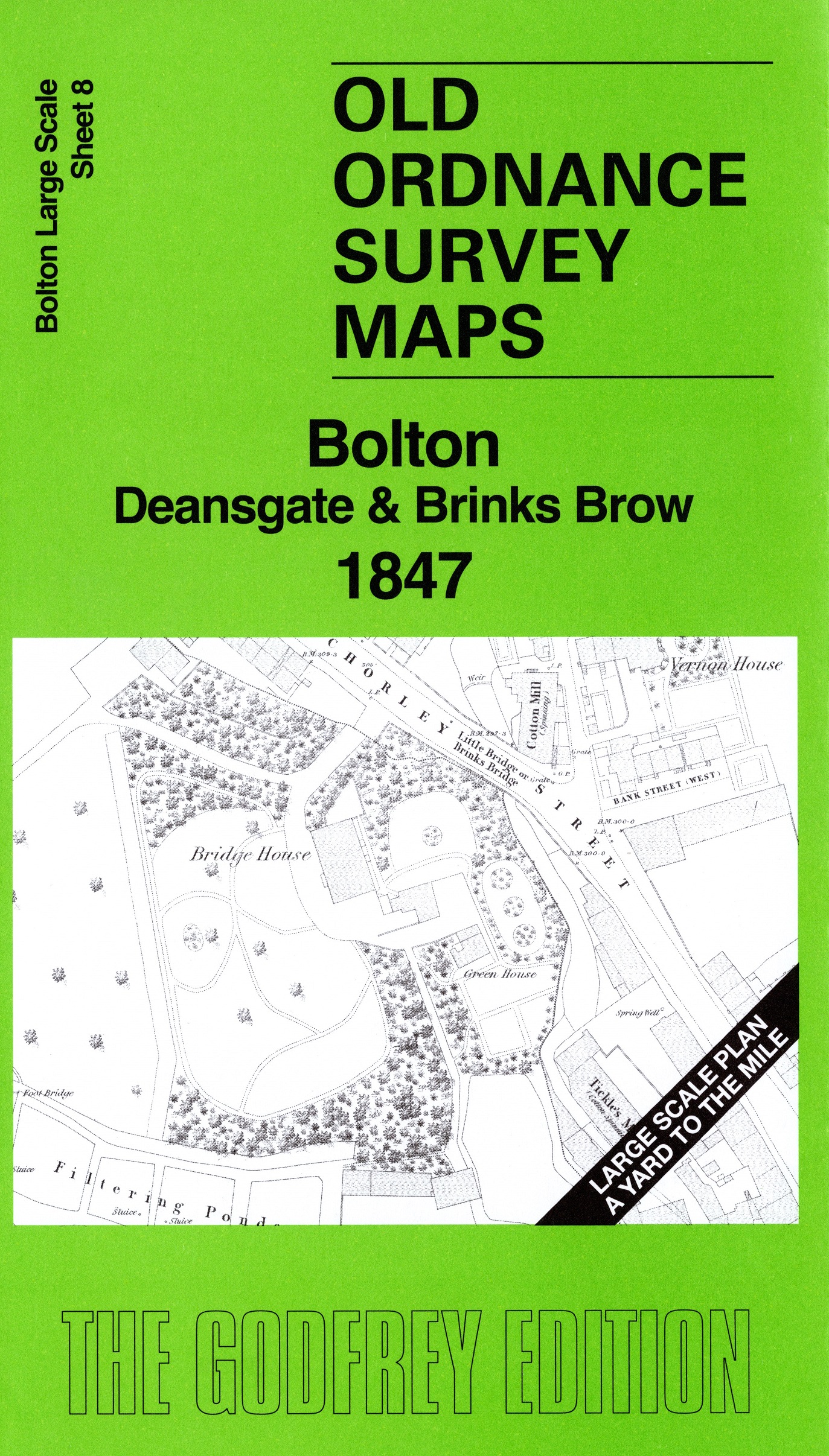
    This very detailed map covers a major area of central Bolton, including Deansgate, the New Market Place, Exchange, the River Croal, St George's Church, Temperance Hall, Unitarian Chapel, Vernon House, Bridge House, and extending to Brinks Brow. Industry includes Globe Mill, gas works, Union Foundry, Great Bridge Mill, Spa Lane Mill, flax mills, etc.

    On the reverse we include 10 foot to the mile sheet 87.134.9 covering the Town Hall area in 1890 together with a 2,000 word introduction to the history of the area.

    The map links up with sheet 9 Bolton Town Centre to the east.


  • Follow this link for a complete list of our Bolton maps or here for all maps in the North West. For other information and prices, and other areas, go to The Index Page.
  • Maps in the Godfrey Edition are taken from the 25 inch to the mile map and reduced to about 15 inches to the mile. For a full list of maps for Lancashire, return to the North West page.
    The Godfrey Edition / sales@alangodfreymaps.co.uk / 25 June 2025