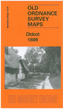
Berkshire Sheet 15.07 Didcot 1898 - published 2014; intro by Michael Jee. ISBN.978-1-84784-790-4 
This detailed map covers most of the village of Didcot together with its large railway station and junction.
Features include GWR station with junction and carriage shed, Corn Exchange, Vauxhall Farm, All Saints church, hotels, Manor Farm, part of Newtown, White Hart Inn etc.
On the reverse we include an 1891 directory of Didcot plus a timetable for the Didcot-Winchester line.
You can order maps direct from our On-line Mapshop.
For other information and prices, and other areas, go to The Index Page.
Maps in the Godfrey Edition are taken from the 25 inch to the mile map and reduced to about 15 inches to the mile.
For a full list of maps for the Berkshire area, return to the Berkshire page or for some adjacent counties go to the Chilterns page.
The Godfrey Edition / sales@alangodfreymaps.co.uk / 22 January 2018

 Here are the details of the map for Didcot: