Old Ordnance Survey Maps of Sheffield Darnall


We have published more than 2,000 maps in our series of Old Ordnance Survey Map reprints, including a large group in South Yorkshire. The maps are highly detailed. They are taken from the OS 1:2,500 (or 25 inch) maps and reduced to about 15 inches to the mile. Each covers an area of a mile and a half by a mile. They show streets with individual houses, tram tracks, railway tracks and even signals, factories, wharves and such details as fountains and water troughs. They will provide hours of fascination for historians and genealogists. The maps are neatly folded and each includes a specially written introduction to the area. Maps can be purchased on our On-line Mapshop where further information about titles is given. Or visit The Index Page for a full list to the series and details of Prices.


Here are the details of maps for Sheffield Darnall:

  • Yorkshire Sheet 295.05 Sheffield (Darnall) 1903 - published 1988; intro by Trevor Lodge

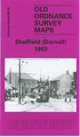
    This detailed map covers an eastern area of Sheffield, including Little Attercliffe and Darnall. Coverage stretches from Ripon Street eastward to High Hazels Park and Handsworth Hill, and from Copster Road southward to Corker Bottoms. Features include Nunnery Colliery, Woodbourn Bridge, Darnall Steel Works, Kettle Bridge Brick Works, Aqueduct Brickworks, Darnall Cemetery, Holy Trinity church, St Andrew's Mission Church, tramways, Victoria Paint Works. The Great Central Railway runs across the map, incl Darnall station, Carriage and Wagon Works, Woodbourn Junction, Attercliffe Junction. A small portion of Attercliffe (top left corner) includes Theatre Royal, Pinfold Bridge. We include a selection of street directory entries on the reverse, incl Bawtry Road, Darnall Road, Industry Road, Main Road, Staniforth Road.

    The map links up with Sheets 295.01 Attercliffe to the north and 294.08 Sheffield to the west.


    Follow this link for a complete list of our Sheffield Series maps.

    You can order maps direct from our On-line Mapshop. For other information and prices, and other areas, go to The Index Page.


    Maps in the Godfrey Edition are taken from the 25 inch to the mile map and reduced to about 15 inches to the mile. For a full list of maps for England, return to the England page.

    Alan Godfrey Maps, Prospect Business Park, Leadgate, Consett, Co Durham, DH8 7PW / godfreyedition@btinternet.com / 12 January 2008