
 Here are the details of maps for Loxley:

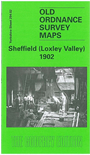
This detailed map covers the an area on the NW side of Sheffield. Coverage stretches from Walkley Bank and Malinbridge westward to Knowle Top, and from Studfield Hill southward to Stannington Road. Features include the hamlets of Malinbridge, Walkley Bank, Wisewood and Loxley. Major features include Wisewood Forge, River Loxley, Low Matlock Rolling Mills, Studfield Hill, Woodland View, Hollins Bridge Mill, Green Wheel Steel Works, Olive Rolling Mill, Boulder Hill, Havelock Steel & Wire Mills. On the reverse we include directories of Loxley and Stannington.
The map links up with Sheets 294.03 Sheffield Neepsend to the east, 294.06 Sheffield Rivelin Glen to the south.