Old Ordnance Survey Maps of Yorkshire

  • These detailed maps normally cover an area of about one and a half miles by one mile. Each map includes an introduction.
  • They are available through our On-line Mapshop

  • Here are the details of maps for Rawmarsh:

  • Yorkshire Sheet 289.03 Rawmarsh 1901 - published 1984; intro by Sally Shepard. ISBN.978-0-907554-87-5

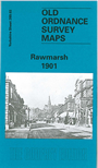
    This detailed map covers Rawmarsh and Park Gate, on the northern fringe of Rotherham. Rawmarsh is in the top half of the map and features here include Low Pottery, Green Lane, St Mary's church, High Street, Pottery Street, the latter reflecting the village's earlier pottery industry. Below Rawmarsh is Park Gate, including Christ Church, Aldwarke Road, Fitzwilliam Pumping Shaft, Rawmarsh Hill, and the northern part of Aldwarke Main Colliery. Parkgate & Aldwarke station is in the extreme SE corner. The Low Stubbin Incline railway runs north-south through the map.

    The map links up with Yorkshire Sheet 289.02 Greasborough to the west and 289.07 Eastwood to the south.


  • You can order maps direct from our On-line Mapshop. For other information and prices, and other areas, go to The Index Page.
  • Maps in the Godfrey Edition are taken from the 25 inch to the mile map and reduced to about 15 inches to the mile. Follow this link for a complete list of our Rotherham maps; or here for the whole Yorkshire series.
    Alan Godfrey Maps, Prospect Business Park, Leadgate, Consett, Co Durham, DH8 7PW / sales@alangodfreymaps.co.uk / 20 Sept 2016