We have published more than 2,000 maps in our series of Old Ordnance Survey Map reprints, including a major group for the Yorkshire area. The maps are highly detailed. They are taken from the OS 1:2,500 (or 25 inch) maps and reduced to about 15 inches to the mile. Each covers an area of a mile and a half by a mile. They show streets with individual houses, tram tracks, railway tracks and even signals, factories, wharves and such details as fountains and water troughs. They will provide hours of fascination for historians and genealogists. The maps are neatly folded and each includes a specially written introduction to the area. Maps can be purchased on our On-line Mapshop where further information about titles is given. Or visit The Index Page for a full list to the series and details of Prices.
Here are the details of maps for Swinton:
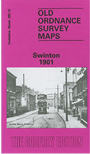
This detailed map covers the Yorkshire town of Swinton, just north of Rotherham, that had developed largely because of the glass and bottling industry. In 1901 it had a population of 12,217 but was ill prepared with poor water and eletricity supply - our map shows many Pumps in the back yards. Most of the town is covered, including Station Street, William Street, Market Street, Bridge Street and surrounding streets and alleys and coverage extends west to Swinton Stables and part of the Old Training Ground. Features include St Margaret's church, Swinton House, Swinton Hall, Fitzwilliam Street, Bow Broom, a stretch of the Midland Railway with station, South Yorkshire Glass Works, Swinton Bridge, a stretch of the GCR railway with station and depot, the GCR Loop Line, Don Pottery, St Michael & All Angels church, River Don. A notable feature is the canal junction between the Dearne & Dove Canal and Mexborough New Cut, with locks. On the reverse we include a directory of Swinton in 1902 plus a small extract of an old Inch to the Mile map for the area.
This map links up with sheets 283.08 Manvers Main to the north, 284.09 Mexborough to the east and 283.16 Kilnhurst to the south.
Follow this link for a complete list of our Doncaster area maps; here for the Rotherham maps; or here for the whole Yorkshire series.
You can order maps direct from our On-line Mapshop. For other information and prices, and other areas, go to The Index Page.
Maps in the Godfrey Edition are taken from the 25 inch to the mile map and reduced to about 15 inches to the mile. For a full list of maps for England, return to the England page.
Alan Godfrey Maps, Prospect Business Park, Leadgate, Consett, Co Durham, DH8 7PW / godfreyedition@btinternet.com / 7 August 2007