
 Here are the details of maps for Wath upon Dearne:

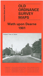
This detailed map covers the town of Wath upon Dearne, the village of West Melton, and the hamlets of Newhill, Gore Hill and Brampton. A short stretch of the GCR railway is shown, including Wath station. The Dearne & Dove Canal runs across the map. Features at Wath include All Saints church, Town Hall, Church Street, cemetery, Wath Brewery, Burlington House, High Street, and all houses individually shown. To the east is Gore Hill, with St James Mission Church, South Yorkshire Oil Soap Works, Green Ings. Eastward is West Melton, incl High Street, Old Hall Farm, streets around Melton Road and Winterwell Road. To the south is Newhill with Newhill Hall, Newhill Grange. On the reverse we include a portion of adjacent sheet 283.06 showing the rest of West Melton, including Christ Church, Melton Green, brick works, Firth Road, and extending to Brampton with Brampton Hall and Brampton House. Extracts from a directory of Wath are also included.
This map links up with sheets 283.08 Manvers Main to the east.