
 Here are the details of maps for Elsecar:

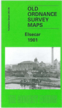
This detailed map covers the villages of Elsecar and Jump, SE of Barnsley, together with several nearby hamlets. Coverage stretches from Jump eastward to Tingle Bridge, and southward to Elsecar Green. Features at Jump include St George's church, Milton Square, Kitroyd, Jump Valley, Arundel View, Flying Dutchman pub. Features at Elsecar include Holy Trinity church, Elsecar Green, Station Row, Old Row, Elsecar Works, Distillery Row, Simon Wood Colliery, Fitzwilliam Street, Reform Row, Cobcar Terrace. Railways include the GCR Elsecar Branch with Elsecar Goods station, and the Midland Railway Chapeltown Branch Extension with Elsecar & Hoyland station. Two railway inclines are shown, plus a good stretch of the Dearne & Dove Canal's Elsecar Branch. The following hamlets are included: Hemingfield, Tingle Bridge, St Helen's, Stubbin, Stubbin Bottom, New Houses (in SW corner). The eastern part of Hoyland Nether is shown, incl Town Hall, Manor House and King Street. Melvyn Jones describes this as "a classic British industrial landscape, reflecting the development of coal mining, iron manufacture, canal and railway development and house building for the workers over a period of more than 150 years". We include directories for Elsecar, Nether Hoyland, Hemingfield and Jump on the reverse.
This map links up with sheets 282.08 Hoyland Nether to the west.
Maps in the Godfrey Edition are taken from the 25 inch to the mile map and reduced to about 15 inches to the mile.
Alan Godfrey Maps, Prospect Business Park, Leadgate, Consett, Co Durham, DH8 7PW / sales@alangodfreymaps.co.uk / 28 January 2018