
 Here are the details of maps for Darfield:

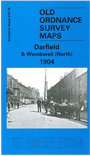
This detailed map covers a group of villages SE of Barnsley. A small portion of Wombwell is in the bottom left corner, incl a stretch of the Dearne & Dove Canal, station on the GCR Barnsley-Barnetby line, Railway Hotel and glass bottle works. North of this a GCR branch runs to Darfield Main Colliery and South Yorkshire Sanitary Tube Works, with all sidings shown; near to them is Netherwood Hall. In the centre of the map is the hamlet of Low Valley, incl Old colliery, Cockstool Bridge. In the NE quarter of the map is Darfield, with Snape Hill, where features include All Saints church, Wombwell Ings (now a valuable bird reserve); Darfield Bridge is in the top right corner, the River Dearne winding down the east edge of the map. Directories of Darfield and Wombwell are included on the reverse.
This map links up with sheets 275.13 Wombwell NW to the west and 283.02 Wombwell South to the south.
Maps in the Godfrey Edition are taken from the 25 inch to the mile map and reduced to about 15 inches to the mile.
Alan Godfrey Maps, Prospect Business Park, Leadgate, Consett, Co Durham, DH8 7PW / sales@alangodfreymaps.co.uk / 28 January 2018