
 Here are the details of maps for Barnsley:


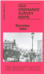
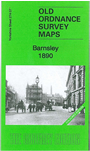
We have published two versions of this detailed map, showing how the area changed across the years. The 1890 version is in full colour, taken from the beautiful 1st Edition OS hand-coloured map. Each map covers most of the town centre, while coverage extends westward to Gawber and northward to Green Foot and New Gawber.
Features include May Day Green, Court House station, Midland Railway and South Yorkshire Railway, Old Mill Bleach Works, Harborough House, Gawber Hall, Hope Works, Taylor's Mill, Jordan Hill, Summer Lane Station, Pog Moor, Workhouse etc. Each map includes extracts from an early directory.
This map links up with Yorkshire Sheets 274.08 Barnsley NE to the east and 274.11 Barnsley South to the south.
Maps in the Godfrey Edition are taken from the 25 inch to the mile map and reduced to about 15 inches to the mile.
Alan Godfrey Maps, Prospect Business Park, Leadgate, Consett, Co Durham, DH8 7PW / sales@alangodfreymaps.co.uk / 28 January 2018