
 Here are the details of maps for Smithies & Monk Bretton:

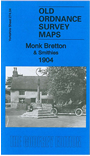
This detailed map covers an area just north of Barnsley, including the hamlet of Smithies and north part of Monk Bretton.
Features include Monk Bretton Colliery, Monk Bretton station, Wallsend Main Colliery.
This map links up with Yorkshire Sheets 275.01 Cudworth to the east and 274.08 Barnsley NE to the south.
Maps in the Godfrey Edition are taken from the 25 inch to the mile map and reduced to about 15 inches to the mile.
Alan Godfrey Maps, Prospect Business Park, Leadgate, Consett, Co Durham, DH8 7PW / sales@alangodfreymaps.co.uk / 28 January 2018