We have very good coverage for Kirklees Metropolitan Borough, which was formed in 1974 from the Dewsbury and Huddersfield County Boroughs, Batley and Spenborough Municipal Boroughs, and Colne Valley, Denby Dale, Heckmondwike, Holmfirth, Kirkburton, Meltham and Mirfield Urban Districts.
The following titles are all taken from the OS 25" maps and reduced to a scale of approximately 14 inches to the mile. Each covers an area of a mile and a half by one mile, and includes an introduction. Click on the links below for further details. All maps are available from our On-line Mapshop.
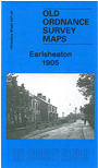 Here are the details of maps for Earlsheaton:

This detailed map covers the eastern part of Dewsbury, centred on the village of Earlsheaton, and part of the village of Gawthorpe, NW of Ossett.
Features include Earlsheaton village, Chickenley, Chickenley Heath, part of Gawthorpe, Soothill Nether Cemtery, GNR Ossett & Dewsbury branch with Earlsheaton station, GNR Chickenley Heath branch with Chickenley Heath station, Ridings Colliery, Hoyle Head Mills, Little Royd Mills, Providence Mill, Jilling Ing Mills, Pildacre Mills, Pildacre Colliery, Savile Colliery, Bant Top Colliery (disused), Earlsheaton Hall, Syke Ing Mill, Bank Top Mill, Royds Mills, St Mary's church, Greengates Mills, etc. On the reverse we include directories of Earls Heaton, Gawthorpe, and Ossett Street in 1889.
The map links up with sheet 232.16 Hanging Heaton to the north, 247.03 Dewsbury to the west, 248.01 Ossett North to the east, 247.08 Ossett SW to the south.