We have very good coverage for Kirklees Metropolitan Borough, which was formed in 1974 from the Dewsbury and Huddersfield County Boroughs, Batley and Spenborough Municipal Boroughs, and Colne Valley, Denby Dale, Heckmondwike, Holmfirth, Kirkburton, Meltham and Mirfield Urban Districts.
The following titles are all taken from the OS 25" maps and reduced to a scale of approximately 14 inches to the mile. Each covers an area of a mile and a half by one mile, and includes an introduction. Click on the links below for further details. All maps are available from our On-line Mapshop.
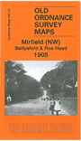 Here are the details of maps for Mirfield NW:

This detailed map covers the NW area of Mirfield, and although it seems, at first glance, relatively empty, it is packed with interest. Coverage extends from Cooper Bridge station eastward to Water Royd Lane, and from Nab Lane northward to Roe Head Mill. Features include Roe Head, where the Bronte sisters went to school, the College of the Resurrection and House of the Resurrection, Nab, Christ Church Battyeford, Bracken Hill, the Three Nuns Inn (named after the three nuns from nearby Kirklees Priory who caused great scandal), sections of the Calder and Battye Ford Cut, West Riding Flour Mills, Nun Brook Print Works, Kitson Hill, Mirfield Moor, Three Nuns Pit with tramway, Mirfield Moor Colliery, Westroyd, Taylor Hall Brickworks, etc. It is said that Robin Hood was buried close to the Three Nuns Inn. On the reverse we include a Battyeford directory, and a commercial directory for Mirfield.
The map links up with sheets 232.13 Roberttown to the north, Mirfield NE247.02 Mirfield NE to the east and 247.05 Mirfield SW to the south.