We have very good coverage for Kirklees Metropolitan Borough, which was formed in 1974 from the Dewsbury and Huddersfield County Boroughs, Batley and Spenborough Municipal Boroughs, and Colne Valley, Denby Dale, Heckmondwike, Holmfirth, Kirkburton, Meltham and Mirfield Urban Districts.
The following titles are all taken from the OS 25" maps and reduced to a scale of approximately 14 inches to the mile. Each covers an area of a mile and a half by one mile, and includes an introduction. Click on the links below for further details. All maps are available from our On-line Mapshop.
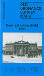
 Here are the details of maps for central Huddersfield:
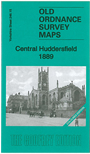


We have published 2 versions of this map, showing how the area developed across the years. The 1889 version is in full colour.
These detailed and busy maps cover the central area of Huddersfield. Coverage stretches from Crosland Moor Bottom and Gledholt Junction eastward to Storths and Longley Hall, and from St Stephens Street northward to Fitzwilliam Street. Features include the station, River Colne, Longley Park, Huddersfield Canal, Rashcliffe, Greenhead Park, Paddock Foot, Lower Fold, Seed Hill, Exchange, St Paul's church, Kings Mills, Folly Hall, Infirmary, Market Hall, tramways, St Peter's church, Color Works, Water Royd Mills, Gledholt, Springdale Mills and many other mills, making this a map of great interest. Engels in the 1840s thought Huddersfield "the most beautiful of the factory towns of Lancashire and Yorkshire". The 1889 map includes street directory entries for Folly Hall, John William Street, King Street, Manchester Street, Market Place and Street, Station Street, Upperhead Row. Th 1905 version also has a selection of street directory entries.
The 1889 version is our first colour printed map in Yorkshire and is taken from the beautiful hand-coloured 1st Edition.
The map links up with sheet 246.11 Huddersfield North to the north, 246.14 Huddersfield West to the west, 246.16 Huddersfield East to the east and 260.03 Huddersfield South to the south.