We have very good coverage for Kirklees Metropolitan Borough, which was formed in 1974 from the Dewsbury and Huddersfield County Boroughs, Batley and Spenborough Municipal Boroughs, and Colne Valley, Denby Dale, Heckmondwike, Holmfirth, Kirkburton, Meltham and Mirfield Urban Districts.
The following titles are all taken from the OS 25" maps and reduced to a scale of approximately 14 inches to the mile. Each covers an area of a mile and a half by one mile, and includes an introduction. Click on the links below for further details. All maps are available from our On-line Mapshop.
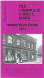 Here are the details of maps for Huddersfield (West), Milnsbridge:

This detailed map covers the western part of Huddersfield, including Longwood, Milnsbridge and Paddock Brow. Coverage stretches from Speedwell Street westward to Botham Hall Road, and from Manchester Road northward to Quarmby Delph. Features include LNWR railway with Longwood & Milnsbridge station, Cliff End Mill, Sunny Bank Mills, Woodland Mills, Botham Hall Siding, Scarbottom, Huddersfield Canal, tramways, Crossland Lodge, River Colne, Elm Ing Mills, Union Mills, numerous other mills, Cliff End, Lower Houses, Prospect Mills, Botham Hall, Royd House, Royds Hall, Royds Mount, Heaton Fold, All Saints church, Johnny Moore's Hill, Milnsbridge Tar Distillery and much more. On the reverse we include street directory entries for Longwood Road, Luck Lane, Morley Lane, Park Road West and Upper Brow Road.
The map links up with sheets 246.10 Lindley cum Quarmby to the north and 246.15 Central Huddersfield to the east.