We have published more than 2,000 maps in our series of Old Ordnance Survey Map reprints, including a group for the Yorkshire area. The maps are highly detailed. They are taken from the OS 1:2,500 (or 25 inch) maps and reduced to about 15 inches to the mile. Each covers an area of a mile and a half by a mile. They show streets with individual houses, tram tracks, railway tracks and even signals, factories, wharves and such details as fountains and water troughs. They will provide hours of fascination for historians and genealogists. The maps are neatly folded and each includes a specially written introduction to the area. Maps can be purchased on our On-line Mapshop where further information about titles is given. Or visit The Index Page for a full list to the series and details of Prices.
Here are the details of maps for Knottingley:
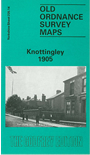
This detailed map, which is double-sided for maximum coverage, covers the Yorkshire town of Knottingley. The main map covers the centre and south of the town, with coverage from The Croft and St Botolph's church southward to Parkbalk Quarry, and from The Holes and Headlands Road eastward to Bank Dole Cut and Trundles Lane Bridge. The Knottingley & Goole Canal is a major feature on the map, with Bank Dole Cut leading to the River Aire. The railway runs through (though the station is on our Ferrybridge South map). Features include Knottingley Sidings, Glass Bottle Works at Bendles, Bacca Green, Fernley Green, Sunny Bank, Low Green, The Hall, Station Glass Works, Jackson's Quarry, cemetery, Aire Tar Works, Tar Distillery, Cow Lane, Weeland Road. On the reverse we include a portion of adjacent sheet 235.10 extending coverage to the north, and this includes the River Aire, Aire Street, Pickhill Garth, Rothery's Croft, Nantes Cottages, Willow Island, Knottingley West Ings. A commercial directory of Knottingley is included.
The map links up with Yorkshire Sheets 235.13 Ferrybridge S to the west
Follow this link for a complete list of our Wakefield maps; or here for the whole Yorkshire series.
You can order maps direct from our On-line Mapshop. For other information and prices, and other areas, go to The Index Page.
Maps in the Godfrey Edition are taken from the 25 inch to the mile map and reduced to about 15 inches to the mile. For a full list of maps for England, return to the England page.
Alan Godfrey Maps, Prospect Business Park, Leadgate, Consett, Co Durham, DH8 7PW / godfreyedition@btinternet.com / 27 July 2007