Old Ordnance Survey Maps of Ferrybridge


We have published more than 2,000 maps in our series of Old Ordnance Survey Map reprints, including a group for the Yorkshire area. The maps are highly detailed. They are taken from the OS 1:2,500 (or 25 inch) maps and reduced to about 15 inches to the mile. Each covers an area of a mile and a half by a mile. They show streets with individual houses, tram tracks, railway tracks and even signals, factories, wharves and such details as fountains and water troughs. They will provide hours of fascination for historians and genealogists. The maps are neatly folded and each includes a specially written introduction to the area. Maps can be purchased on our On-line Mapshop where further information about titles is given. Or visit The Index Page for a full list to the series and details of Prices.


Here are the details of maps for Ferrybridge:

  • Yorkshire Sheet 235.09 Ferrybridge 1905 - published 1990; introduction by John Goodchild

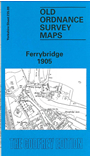
    This detailed map covers the centre and northern part of Ferrybridge, well known as an important stop on the Great North Road, but also busy as a transhipment point where the Knottingley & Goole Canal joins the River Aire. Coverage of this map runs from the station northward to Low Street, Brotherton. Features include the canal and Ferrybridge Lock, the actual Ferry Bridge, St Andrew's church, West Riding Pottery, Australian Pottery, Ferrybridge Pottery, The Square, Fishergate, Town's Street, Strangland Lane, Holmfield Lane, Fryston Cottage. By way of contrast, on the reverse we include a large section of the earlier edition of this map, showing how the area looked in 1890. Directories of Ferrybridge and New Fryston are also included.

    The map links up with sheet 235.13 Ferrybridge South to the south.


    Follow this link for a complete list of our Wakefield maps; or here for the whole Yorkshire series.

    You can order maps direct from our On-line Mapshop. For other information and prices, and other areas, go to The Index Page.


    Maps in the Godfrey Edition are taken from the 25 inch to the mile map and reduced to about 15 inches to the mile. For a full list of maps for England, return to the England page.

    Alan Godfrey Maps, Prospect Business Park, Leadgate, Consett, Co Durham, DH8 7PW / godfreyedition@btinternet.com / 27 July 2007