We have published more than 2,000 maps in our series of Old Ordnance Survey Map reprints, including a group for the Yorkshire area. The maps are highly detailed. They are taken from the OS 1:2,500 (or 25 inch) maps and reduced to about 15 inches to the mile. Each covers an area of a mile and a half by a mile. They show streets with individual houses, tram tracks, railway tracks and even signals, factories, wharves and such details as fountains and water troughs. They will provide hours of fascination for historians and genealogists. The maps are neatly folded and each includes a specially written introduction to the area. Maps can be purchased on our On-line Mapshop where further information about titles is given. Or visit The Index Page for a full list to the series and details of Prices.
Here are the details of maps for Castleford:
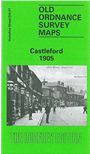
This detailed map covers the West Riding town of Castleford, described only as "a large and pleasant village" in an 1838 directory. However, it has an ancient history and the site of the Roman Camp of Legeolium is on the map. Our map covers the centre of the town and the area to the north. The River Aire winds through the map and two significant factories are on its banks: Aire & Calder Chemical Works and Aire & Calder Bottle Works. The Castleford Cut canal is shown with Castleford Locks and Bulholme Lock. Features on the map include Market Hall, several maltkilns, cemetery, Carlton Street, All Saints church, tramways in town centre, Church Street, Bank Street, railways (but not station) including part of Whitwood Branch, Methley Road, Allerton Ings, Ledston Ings, Red Hill Brick Works, Healdfield Brick Works, Castleford Ings, Wheldale Ings, Wheldale Basin and railway siding, Wheldale Collieries, Castleford Bridge, Extracts from a contemporary directory include a list of private residents and the commercial directory A-G.
Follow this link for a complete list of our Wakefield maps; or here for the whole Yorkshire series.
You can order maps direct from our On-line Mapshop. For other information and prices, and other areas, go to The Index Page.
Maps in the Godfrey Edition are taken from the 25 inch to the mile map and reduced to about 15 inches to the mile. For a full list of maps for England, return to the England page.
Alan Godfrey Maps, Prospect Business Park, Leadgate, Consett, Co Durham, DH8 7PW / godfreyedition@btinternet.com / 31 July 2007