We have very good coverage for Kirklees Metropolitan Borough, which was formed in 1974 from the Dewsbury and Huddersfield County Boroughs, Batley and Spenborough Municipal Boroughs, and Colne Valley, Denby Dale, Heckmondwike, Holmfirth, Kirkburton, Meltham and Mirfield Urban Districts.
The following titles are all taken from the OS 25" maps and reduced to a scale of approximately 14 inches to the mile. Each covers an area of a mile and a half by one mile, and includes an introduction. Click on the links below for further details. All maps are available from our On-line Mapshop.
 Here are the details of maps for south Cleckheaton:

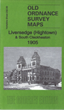
This detailed map covers the southern half of Cleckheaton, especially along Westgate, and the Hightown area of Liversedge.
Features include Marsh Mills, Rawfolds Mill, Rawfolds Dye Works, Stanley Mills, Upper Carr Mills, Eddercliff, Pyenot Hall, Syke House, Brook Mills, St Peg Mills, LYR Cleckheaton Branch railway with part of Cleckheaton and Liversedge stations, Stanley Colliery, Liversedge Town Hall, Middle Gate, Knowler Hill, tramways, Aquila, Hightown Heights, St Barnabas church, Rayners Mill, Upper Blacup, Lower Blacup, Moorbottom, Broomfield Mills, St Luke's church etc.
The map links up with sheet 232.05 Cleckheaton to the north, 232.10 Liversedge to the east, 232.13 Roberttown to the south.