We have very good coverage for Kirklees Metropolitan Borough, which was formed in 1974 from the Dewsbury and Huddersfield County Boroughs, Batley and Spenborough Municipal Boroughs, and Colne Valley, Denby Dale, Heckmondwike, Holmfirth, Kirkburton, Meltham and Mirfield Urban Districts.
The following titles are all taken from the OS 25" maps and reduced to a scale of approximately 14 inches to the mile. Each covers an area of a mile and a half by one mile, and includes an introduction. Click on the links below for further details. All maps are available from our On-line Mapshop.
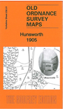 Here are the details of maps for Hunsworth:

This detailed map covers the village of Hunsworth, just north of Cleckheaton, with coverage stretching eastward to Oakroyd Hall.
Features include Hunsworth village, Savile Arms, Copley House, Hunsworth Engine House, Hill Pits, Valley Pit, Hunsworth Lodge, northern part of Drub hamlet, Gomersal Field Head, North Bierley Joint Hospital, Wood Pit (disused), Road Pit (disused), Oak Mill, part of Hunsworth Mills, Hunsworth House, several colliery tramways etc. On the reverse we include an 1889 directory for Hunsworth plus photographs of the Wright family of Hunsworth Lodge Farm.
The map links up with sheet 231.04 Oakenshaw & Wyke to the west, 217.13 East Bierley to the north, 232.02 Birkenshaw to the east, 232.05 Cleckheaton to the south.