
 Here are the details of maps for Halifax (South)


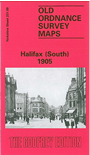
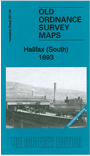
We have published two version of this detailed map, showing how the area changed across the years. Each covers the southern part of central Halifax, with coverage stretching from the Borough Market southward to Dryclough Junction and Manor Heath Road, and from Savile Park eastward to Higgin Lane and Manor House Inn.
Features include the Piece Hall, Joint railway station or Old Station and southern approaches, goods sheds, Calder & Hebble Navigation, Horton Street, Southgate, Commercial Street, Victoria Hall, tramways and depot (1905 map), Shaw Lodge Mills, Borough Fever Hospital, cemetery, Atlas Carpet Works, Bailey Hall Mill, St Michael's church, Cinder Hills Fire Clay Works, Blaithroyd, Pineberry Hill, Holy Trinity church, Heath Villas, Heath Grammar School, Royal Halifax Infirmary, Crossley & Porter Orphan Home, Savile Park, King Cross Street, Brunswick Mills, Hopwood Lane, Lister Lane, Well Head Farm etc. On the reverse we include a selection of street directory entries.
The 1893 version is fully coloured, taken from the beautiful 1st Edition OS handcoloured edition.
The map links up with Sheets 231.05 Halifax North to the north, 230.12 Sowerby Bridge to the west and 231.13 Halifax SE to the south.
You can order maps direct from our On-line Mapshop. For other information and prices, and other areas, go to The Index Page.
Maps in the Godfrey Edition are taken from the 25 inch to the mile map and reduced to about 15 inches to the mile. Follow this link for a complete list of our Calderdale maps; or here for the whole Yorkshire series.
Alan Godfrey Maps, Prospect Business Park, Leadgate, Consett, Co Durham, DH8 7PW / sales@alangodfreymaps.co.uk / 20 Sept 2016