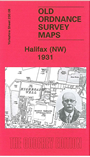
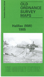
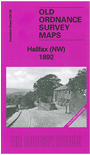
We have published three maps for NW Halifax, showing how the area developed across the years. The maps include parts of
Ovenden and Pellon Wards. Coverage stretches from Queens Road westward to Royles Head Reservoir, and from Victoria Cattle
Market northward to Wheatley Dye Works and part of Wheatley itself.
Features include Ryburne Mills, Hanson Lane, Battinson Road, Halifax High Level Branch and Pellon station, Snake Hill Wood, Brackenbed Brewery, Halifax Barracks, Highroad Well,
Albert Reservoir, New Pellon, Mount Pellon, Brackenbed Grange, Blackwood Mill, racecourse, Ruston Works, Norton Tower, Warley Edge, Highroad Well Moor,
Dodgson Wood, Ovenden Wood Brewery, etc. Each map includes extracts from a street directory, the 1892 map including Hanson Lane, Mount Pellon, Pellon Lane and Queen's Road from an 1889 directory.
Note that the 1892 version is in colour, taken from the beautiful 1st Edition handcoloured map.
The map links up with Sheets 230.04 Mixenden to the north, 231.05 Halifax North to the east, and 230.12 Sowerby Bridge to the south.
You can order maps direct from our On-line Mapshop.
For other information and prices, and other areas, go to The Index Page.
Maps in the Godfrey Edition are taken from the 25 inch to the mile map and reduced to about 15 inches to the mile.
Follow this link for a complete list of our Calderdale maps; or here for the
whole Yorkshire series.