
 Here are the details of maps for Hebden Bridge:

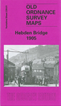
This detailed map covers the popular town of Hebden Bridge, and coverage also continues NE to the hamlet of Chisley. Most of Hebden Bridge town is shown and features here include railway station, Rochdale Canal, Calder Mill, Bank Foot Bridge, Hanging Royd House, Nutclough Works, Machpelah, Birchcliffe, Foster Mill, Fairfield, May Royd Mill, Wood End, Owler Bank, Hebden Water. The village of Heptonstall is in the top left corner, with St Thomas church. Eastward is Chisley, with Acre Mill, and south of this is Little Moor, with scattered cottages and the Mount Skip Inn. On the reverse we include a commercial directory of the town in 1901.
You can order maps direct from our On-line Mapshop. For other information and prices, and other areas, go to The Index Page.
Maps in the Godfrey Edition are taken from the 25 inch to the mile map and reduced to about 15 inches to the mile. Follow this link for a complete list of our Calderdale maps; or here for the whole Yorkshire series.
Alan Godfrey Maps, Prospect Business Park, Leadgate, Consett, Co Durham, DH8 7PW / sales@alangodfreymaps.co.uk / 20 Sept 2016