Old Ordnance Survey Maps of Wortley


We have published more than 2,000 maps in our series of Old Ordnance Survey Map reprints, including a major group for the Leeds area. The maps are highly detailed. They are taken from the OS 1:2,500 (or 25 inch) maps and reduced to about 15 inches to the mile. Each covers an area of a mile and a half by a mile. They show streets with individual houses, tram tracks, railway tracks and even signals, factories, wharves and such details as fountains and water troughs. They will provide hours of fascination for historians and genealogists. The maps are neatly folded and each includes a specially written introduction to the area. Maps can be purchased on our On-line Mapshop where further information about titles is given. Or visit The Index Page for a full list to the series and details of Prices.


Here are the details of maps for Wortley:

  • Yorkshire Sheet 217.08 Wortley & Old Farnley 1906 - published 2002; introduction by Alan Godfrey

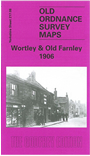
    This detailed map covers the Wortley area of SW Leeds. Coverage stretches from Armley Town Street southward to Lower Wortley, and westward to Butt Lane. Areas covered include Upper Wortley, Lower Wortley, Green Hill, Wiring Field, Wortley Town End, Swallow Hill, Silver Royd Hill, New Blackpool, Farnley, Carr Crofts. This is a busy map and the many features include Antwerp Mills, GNR railway with Armley & Wortley station and sidings, Cliff's Upper Yard and Ingham's Fire Clay Works (both with tramway), Wortley Grange, Western Flats Park, Low Mills, St John's church, Cow Close, Butterbowl Mills, the large Stone Bridge Mills, Farnley Manor House, Farnley Park (at western edge of map). A map of contrasts, leading from the crowded streets and back-to-backs of Armley and Upper Wortley to the rural village of old Farnley. On the reverse we include a good selection of street directory entries, including Cedar Road/Street/Terrace, Claremont Street/Terrace, Farnley Hill, Lower Wortley Road, Silver Royd Hill, Upper Wortley Ropad, Whingate Road.


    The map links up with Sheets 217.04 Armley to the north, 218.05 Holbeck to the east.


    Follow this link for a complete list of our Bradford and Leedsarea maps; or here for the whole Yorkshire series.

    You can order maps direct from our On-line Mapshop. For other information and prices, and other areas, go to The Index Page.


    Maps in the Godfrey Edition are taken from the 25 inch to the mile map and reduced to about 15 inches to the mile. For a full list of maps for England, return to the England page.

    Alan Godfrey Maps, Prospect Business Park, Leadgate, Consett, Co Durham, DH8 7PW / godfreyedition@btinternet.com / 8 August 2007