
 Here are the details of maps for Bradford East:
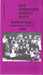


We have published two versions of this map, showing how the area changed across the years. The 1890 version is in colour, taken from the 1st Edition OS handcoloured map.
These detailed maps covers the eastern part of Bradford which includes Laisterdyke and Tyersall. Coverage stretches from Birksland Street eastward to Tyersall Hall, and from Maidstone Street southward to Tyersall Gate. Features on the map include Holy Trinity church, Fever Hospital, Penny Oaks Mill, Hillside Mills, Hubert Shed, Gas Works, Albion Works, Bowling Iron Works, St John's church, Upper Croft Mills, Swain Green, Alexandra Shed, New Lane Mills, Quarry Gap Row, Laisterdyke Brick Works, Tyersall Mill (disused), Tyersall House, Cutler Heights. Several sections of the GNR Bradford Branch are shown, including Laisterdyke station, Quarry Gap Junction, Cutlers Junction, Broad Lane Junction, Tyersall Junction. The maps show this as an area under change, with many streets only partly built up. Most of the others have back-to-back houses. We include extracts from early directories on the reverse.
The map links up with sheets 217.01 Thornbury & Bradford Moor to the north, 216.08 Bradford to the west, 217.06 Pudsey Chapeltown to the east, 217.09 Dudley Hill to the south..