
 Here are the details of maps for Bradford:

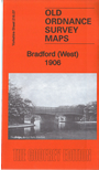
This detailed map covers an area just west of Bradford city centre, with coverage extending from Dirk Hill and Legrams Mill westward to Scholemoor and Paradise Green. Lidget Green is in the centre of the map.
Features include Crossley Hall Dye Works, Scholemoor Cemetery, Paradise Green, Lidget Green, Victoria Dye Works, Beck Side Mills, St Wilfrid's church, Horton Iron Works, Alston Works, tramways, Bentley Mills, Legrams Mill, GNR City Branch, Dirk Hill, St Columba's church, part of Horton Park, GNR Bradford & Thornton railway with Great Horton station, Sellers Fold, Cannon's Mill etc. Extracts from a 1912 street directory are included on the reverse.
The map links up with sheet 216.03 Girlington to the north, 216.06 Clayton to the west, 216.08 Bradford to the east, 216.11 Great Horton to the south.